Empowering Career Growth

The impact of GNSS and GPR on the Surveying profession is transformative
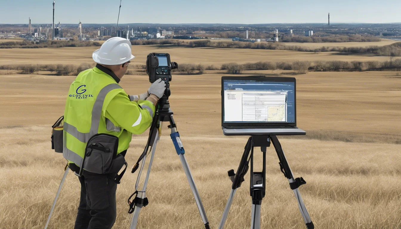
We’ve witnessed a remarkable transformation in the surveying profession, thanks to the introduction of Global Navigation Satellite Systems (GNSS) and Ground Penetrating Radar (GPR). These technologies have revolutionized how we collect, analyze, and interpret spatial data, opening up new possibilities in GIS roles and geographic information science careers. As professionals in this field, we’ve seen firsthand how these advancements have reshaped our work, boosting accuracy and efficiency to levels once thought impossible.
What’s more, the impact of GNSS and GPR goes beyond just improving our tools. They’ve changed the very nature of our jobs, creating new opportunities to climb the career ladder and pursue our passions. In this article, we’ll explore how these technologies have evolved, their individual contributions to modern surveying, and the powerful synergy they create when used together. We’ll also look at the far-reaching effects on our profession and the exciting future that lies ahead for surveyors and GIS specialists.
The Evolution of Surveying Technology
Traditional surveying methods
We’ve come a long way from the ancient techniques used by civilizations like Egypt and Babylonia. Traditional surveying methods relied on simple tools such as compasses, chains, and theodolites. These instruments allowed us to measure distances, angles, and elevations with reasonable accuracy. However, they had their limitations. The process was often time-consuming, labor-intensive, and prone to human error. Despite these drawbacks, traditional methods served us well for centuries, especially in small to medium-sized projects that required high precision.
Introduction of GNSS
The introduction of Global Navigation Satellite Systems (GNSS) in the late 20th century was a game-changer for our profession. This technology revolutionized how we collect and analyze spatial data, opening up new possibilities in gis roles. GNSS allows us to obtain precise geographic coordinates using satellite signals, significantly improving the speed and accuracy of our surveys. It’s particularly useful for large-scale topographic surveys where centimeter-level accuracy is acceptable. The adoption of GNSS has had a profound impact on geographic information science careers, enabling us to tackle projects that were once considered impractical or impossible.
Emergence of GPR
Ground Penetrating Radar (GPR) has emerged as another transformative technology in our field. GPR uses high-frequency radio waves to image the subsurface, allowing us to detect underground structures, utilities, and anomalies without disturbing the ground. This non-destructive method has become indispensable in construction, archeology, and environmental studies. It’s particularly valuable in urban environments where understanding the subsurface is crucial for planning and safety. The emergence of GPR has created new opportunities for advancement up a career ladder, allowing us to specialize in subsurface mapping and analysis.
GNSS: Revolutionizing Precision and Efficiency
How GNSS works
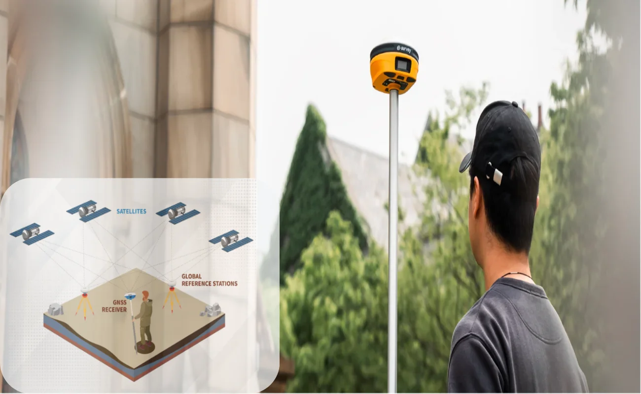
Global Navigation Satellite Systems (GNSS) have transformed the surveying industry, offering unprecedented accuracy and efficiency. GNSS technology relies on a network of satellites orbiting Earth, transmitting signals to receivers on the ground. These receivers use the signals to calculate their precise location, providing surveyors with accurate positioning data. The system works by measuring the time it takes for signals to travel from satellites to the receiver, then using this information to triangulate the receiver’s position.
Benefits for surveyors
The adoption of GNSS technology has brought numerous advantages to gis roles and geographic information science careers. One of the most significant benefits is the dramatic increase in accuracy. Modern GNSS receivers can achieve centimeter-level precision, which is crucial for detailed mapping and construction projects. This level of accuracy has opened up new opportunities for advancement up a career ladder in the surveying profession.
GNSS technology has also greatly improved efficiency in surveying tasks. What once took days to complete can now be done in hours or even minutes. This increased productivity allows surveyors to take on more projects and explore their passions within the field. Additionally, GNSS receivers offer flexibility, enabling surveyors to work in various terrains and conditions that were previously challenging or impossible to survey using traditional methods.
Challenges and limitations
Despite its many advantages, GNSS technology does face some challenges. One of the primary issues is signal obstruction, which can occur in urban environments or areas with dense tree cover. These obstacles can interfere with satellite signals, potentially reducing accuracy or causing signal loss. Multipath errors, where signals bounce off surfaces before reaching the receiver, can also impact precision.
GPR: Unveiling the Unseen
Principles of GPR technology
Ground Penetrating Radar (GPR) is a cutting-edge technology that has revolutionized gis roles and geographic information science careers. It works by emitting high-frequency electromagnetic waves into the ground and analyzing the reflections of those waves off subsurface objects or features. This non-invasive method allows us to create detailed images of what lies beneath the surface without disturbing the ground.
The GPR system consists of a transmitter and a receiver antenna. The transmitter sends pulse signals underground, which are then reflected, refracted, or scattered when they encounter objects or changes in material properties. The receiving antenna detects these returning signals and records their variations. Sophisticated software then translates these signals into images of subsurface structures, providing us with valuable insights for our projects.
Applications in surveying
GPR has a wide range of applications in surveying, opening up new opportunities for advancement up a career ladder in our field. We use it to detect and map underground utilities, including water pipes, electrical cables, and gas lines. This technology is invaluable for archeological investigations, allowing us to locate buried artifacts and map entire sites without excavation. In environmental studies, GPR helps us identify contamination plumes and assess landfill boundaries.
Advantages over conventional methods
One of the most significant advantages of GPR is its ability to provide high-resolution images of the subsurface quickly and non-destructively. This efficiency allows us to cover large areas in a short time, making it cost-effective for many projects. GPR can detect both metallic and non-metallic objects, giving us a comprehensive view of underground structures. It also allows us to measure the dimensions, depth, and thickness of targets, providing crucial information for our passions in geospatial analysis and planning.
The Synergy of GNSS and GPR in Modern Surveying
Integrated surveying approaches
The combination of Global Navigation Satellite Systems (GNSS) and Ground Penetrating Radar (GPR) has revolutionized gis roles, creating a powerful synergy in modern surveying. This integrated approach allows us to capture a comprehensive picture of both above-ground and subsurface features, enhancing our ability to provide accurate and detailed information.
By combining GNSS and GPR technologies, we can now map underground utilities, archeological sites, and geological features with unprecedented precision. This integration has opened up new opportunities for advancement up a career ladder in geographic information science careers, as professionals with expertise in both technologies are in high demand.
Enhanced data accuracy and completeness
The integration of GNSS and GPR has significantly improved data accuracy and completeness in surveying projects. GNSS provides precise positioning data, while GPR offers detailed subsurface information. When used together, these technologies allow us to create more comprehensive and accurate 3D models of both surface and underground features.
This enhanced accuracy has had a profound impact on various industries, including construction, urban planning, and environmental studies. For example, in urban environments, we can now easily identify potential conflicts between existing underground utilities and proposed construction projects, reducing the risk of costly mistakes and delays 1.
Future possibilities
The future of integrated GNSS and GPR surveying looks promising, with ongoing technological advancements opening up new possibilities. The development of more compact and efficient systems is making it easier for us to pursue our passions in geospatial analysis and mapping.
Emerging technologies, such as artificial intelligence and machine learning, are being incorporated into GNSS and GPR systems, further enhancing their capabilities. These advancements are expected to improve data interpretation, automate certain processes, and increase overall efficiency in surveying tasks.
Conclusion
The integration of GNSS and GPR has caused a revolution in the surveying profession, transforming how we collect, analyze, and interpret spatial data. These technologies have boosted accuracy and efficiency, opening up new avenues to climb the career ladder in GIS roles and geographic information science careers. Their combined use has enabled us to create more detailed and comprehensive 3D models, merging above-ground and subsurface information with unprecedented precision.
Looking ahead, the future of integrated GNSS and GPR surveying is bright, with ongoing advancements paving the way for even more groundbreaking applications. As these technologies continue to evolve, they’ll likely have an even bigger impact on various industries, from construction to environmental studies. For surveyors and GIS specialists, this means more opportunities to explore their passions and take on exciting new challenges in the ever-changing world of geospatial analysis and mapping.
FAQs
1. Why is GNSS crucial for surveying?
GNSS is pivotal in surveying because it allows for the quick, accurate, and reliable positioning of detailed points, such as those that need to be mapped within a controlled survey area. This technology ensures precision in capturing the necessary features of a surveyed location.
2. How has the evolution of technology influenced surveying?
The introduction of GPS technology has dramatically accelerated the surveying process. Survey teams no longer rely on traditional sighting and measurement methods to delineate parcel boundaries and identify critical points. GPS enables efficient surveying across various terrains and remote areas.
3. What are the various uses of GNSS in surveying?
GNSS is instrumental in geodetic surveying, where it helps measure the Earth’s shape, size, and spatial orientation. It is also used to pinpoint precise locations on the Earth’s surface, aiding in the creation of accurate maps, determining land boundaries, and conducting comprehensive geodetic surveys.
4. What advantages does GPS technology offer in surveying?
GPS technology provides exact latitude and longitude information, which is crucial for surveying under any weather conditions and without the need for traditional measurements of angles and distances between points. Although highly effective, GPS technology does have some limitations.
Our Contact Information
☎️ 00971503815136 / Sharjah
Info@geosmartcivil.com 🌐🛰️🌍
Geo Smart Civil

