PolyMap Editor
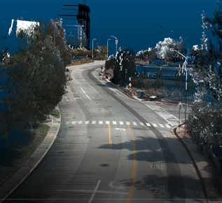
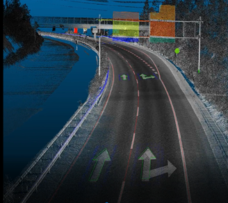
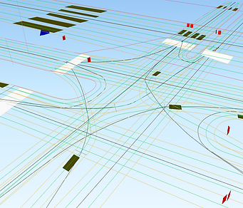
PolyMap Editor is a cloud-based platform for HD maps. It allows the users to edit and manage 3D point cloud and imagery. It significantly increases the efficiency to create HD maps by enabling multiple users to work on various tasks simultaneously. It can export the map product with one click to different formats, such as SHP, OpenDRIVE, GeoJSON and any customized format. The web-browser interface is easy to use, and the cloud infrastructure provides enhanced security, flexibility, and control for the users. The distinguished admin portal and user portal ensures security compliance. The PolyMap Editor optimizes resource allocation and streamlines the workflow of map production.
AI- Based Feature Extraction
MOBILE ASSET MANAGEMENT SOLUTIONS
AI-based asset management services by Polyexplore provide customers with real-time analytics, predictive insights, and automated alerts. These services enable customers to monitor and track their assets more efficiently and identify any potential problems or areas of improvement. Customers can also use the digital twin models to predict future asset performance and optimize operations. Additionally, Polyexplore’s asset management services enable customers to optimize the use of resources, reduce costs, and improve sustainability.
PolyExplore Inc. offers a different, complex approach to combining aerial and mobile-based tools with AI-based automatic feature extraction capabilities. Mobile HD mapping scanners can reach deep in the neighborhoods. Polyexplore software solutions allow aerial and mobile data fusion into a single, high-density HD map of assets with 2 cm accuracy and mm relative precision. We also offer automated feature extraction such as poles, wires and transformers, and other equipment on the poles and ground. The system is also widely used to maintain other infrastructures, such as gas and oil pipelines.
>>> more details, contact us
SERVICES
PolyExplore Inc. offers a comprehensive mapping solution. The company’s proprietary mapping technology enables them to generate HD maps quickly and accurately, with precision under 10 cm. The maps include road boundary information, lane markings, intersections, turn restrictions, and other important road features. The maps are updated on a regular basis and are compatible with various navigation systems.
With the help of advanced AI technologies, the company’s HD maps can detect and differentiate various road elements such as curbs, pavements, and traffic signs. This helps autonomous vehicles to quickly and accurately detect and respond to their environment. The company also offers custom mapping services, allowing customers to tailor the maps to their specific needs.
PolyExplore Inc.’s HD maps enable autonomous vehicles to navigate the roads safely and efficiently. The company’s mapping technology is set to revolutionize the autonomous driving industry and make self-driving cars a reality in the near future.
>>>> more details, contact us
DATA COLLECTION
Field Data Collection
High accuracy, 5 cm absolute. High speed, large scale, low cost Annotated las files, trajectory, and accuracy reports.
Images with geo and time-tagged Colorized point cloud data.
FEATURE EXTRACTION
Road Features
Lane, Pole, Traffic Signs, Curb, and Manhole cover detection and extraction.
Road borders and guardrails
HD MAPPING
HD Map Format
SHP, OpenDrive, OpenCRG, Geojson, and database.


